WeChat ID
aaronpk_tv
#press
-
Geoloqi exits beta, reveals geolocation tools for enterprise developers - FierceDeveloper (www.fiercedeveloper.com)
-
Geoloqi offers up tools so location apps can finally realize their potential (www.digitaltrends.com)
-
Geoloqi Launches Powerful Next Generation Location Based Service Platform (telecommunicationnews.net)
-
Geoloqi - Foursquare's Biggest Threat? (blogs.forbes.com)
Geoloqi is a fully customizable GPS-based application that lets you set your own reminders, rules and notes based on your geographic location. Think FourSquare without the exhibitionism. Geoloqi, the brainchild of cyborg anthropologist Amber Case and her partner Aaron Parecki, will use GPS technology to map users, but not broadcast their locations to the world—only those they choose to share it with and when.
The app lets you decide how long to share your location. "I'd like to share my location with a client if I’m meeting them somewhere, so they can know when I'll arrive," writes co-founder Parecki in a web presentation on the faults of other location-mapping products including Foursquare, Dopplr and Gowalla. "But after our meeting, I absolutely don't want them to access my location. This is often true even with friends. Friends' location is not always relevant to me. Current location-sharing systems are currently all or nothing."
...
"This is a very different approach to sharing than most social networks take," Parecki points out, "Since we don’t limit to sharing with other Geoloqi users."
The Portland-based pair of Parecki and Case has so far received no major financial backing, and Parecki says all design and development has been done by volunteers who are helping out because they are "very interested in the project." Pricing for the application, which will be released as a public beta in January and will be available at the app store has not been finalized.
With no millions of VC money to prop them up, I wondered to Parecki how Geoloqi hopes to be self-sustaining in the year to come, and his response was far from the advertising-based answer I expected. "We plan on licensing the iPhone software development kit to developers who want to integrate location into their own apps," he told me. "Also we will likely charge developers for heavy application programming interface access if they go over a certain threshold."
-
What's Next for Check-In Apps? (www.cnn.com)
An open-source group called geoloqi is trying to take that idea of an automated check-in radius even further.
The volunteer group of app developers, which is based in Portland, Oregon, is working on a website and app that will help trigger events if and when a person walks up to certain pre-set locations.
For example, you would be able to set the app to text you your shopping list when you went within a certain distance of your favorite grocery store.
Or, if you didn't show up to work by 9 a.m., you could set the app automatically to e-mail your boss saying that you're late, said Aaron Parecki, geoloqi's founder.
"We're calling these geonotes," he said, "and these are location-based notes so you can leave yourself a note that is tied to a location and pops up when you're there."
The site and the app should be up and running in about a month, he said. Geoloqi won't be a social network, exactly, but it could be integrated into Foursquare, Gowalla or other location-based networks, he said. The group has one new project up -- it's a Seattle, Washington-based website that can send you a text message, in real time, when a 911 call is placed within a certain radius of you.
-
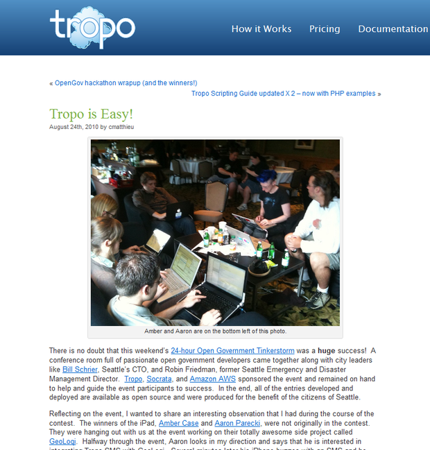
Geoloqi-powered ChatterCast Wins Open Government Hackathon (blog.tropo.com)
There is no doubt that this weekend’s 24-hour Open Government Tinkerstorm was a huge success! A conference room full of passionate open government developers came together along with city leaders like Bill Schrier, Seattle’s CTO, and Robin Friedman, former Seattle Emergency and Disaster Management Director. Tropo, Socrata, and Amazon AWS sponsored the event and remained on hand to help and guide the event participants to success. In the end, all of the entries developed and deployed are available as open source and were produced for the benefit of the citizens of Seattle.
Reflecting on the event, I wanted to share an interesting observation that I had during the course of the contest. The winners of the iPad, Amber Case and Aaron Parecki, were not originally in the contest. They were hanging out with us at the event working on their totally awesome side project called GeoLoqi. Halfway through the event, Aaron looks in my direction and says that he is interested in integrating Tropo SMS with GeoLoqi. Several minutes later his iPhone buzzes with an SMS and he looks at me and Amber and says, “It worked! GeoLoqi just me an SMS notification triggered by my location!” This was certainly very exciting for all of us but it the event gets more interesting…
Amber and Aaron left to get some sleep and came back in the morning for breakfast with an idea to enter the contest. Their idea was ChatterCast, a mashup of Tropo, Socrata’s data.seattle.gov, Instamapper, and GeoLoqi services. Basically ChatterCast subscribes your phone to real-time 911 call data provided by http://data.seattle.gov. ChatterCast alerts you based on your location of 911 events happening around you.
This is a great example of how someone with an idea can not only win a contest only after getting started in the final hours but how anyone with an idea can change the world. Tropo’s ease of use makes it super easy to communicate with telephones via voice and SMS or even IM and Twitter with a couple of lines a code. There’s no reason not to add telephone support to your existing web applications to make them even more powerful in this mobile and social age we live in today. So what are you waiting on? Sign-up for Tropo today and change the world!
-
Recess Gallery Presents Social_Net_Works (blogtown.portlandmercury.com)
Tonight from 6-9 pm, Social_Net_Works opens over at Recess Gallery (4315 SE Division, inside the Artistery), featuring artwork inspired by social networks. I've gotta admit, these projects sound pretty awesome: Alicia Gordon is showing photos which she shot during "Casual Encounters" arranged through Craigslist; J.P. Huckins is truncating a previous social experiment, Best Friends For A Day, to present, Best Friends For Ten Minutes (it's exactly what it sounds like— you'll be BFing with Huckins for ten); and according to Hungry Eyeball, Dane Overton "has converted two monitors into cyborgs that will attempt to communicate while observers can send them text messages to provoke or interrupt the conversation."
While the above projects sound great, l'm most intrigued by Aaron Parecki and Amber Case's GPS-generated self-portraits. Parecki has been logging his location every seven seconds via a mobile GPS tracker for the last two years; and for the past six months, Case has been doing the same. Using the GPS data gathered, experiential portraits have been generated, representing the artists' lives not in literal pictures of the body, but in images of where the body has been— plotting the artists' movements onto maps, and color-coding these movements under variables like time of day, speed of movement, etc.. See some examples here, or stop by Recess tonight.
-
The Future of Location Services: Recommendation (www.readwriteweb.com)
Last month, I decided to take to the road with my blogging. Armed with a 12-inch netbook, an iPhone and a 1995 Chevy Astro Van, I've hit the paved pathways with many intentions to see just how mobile technology can or cannot determine how we approach and experience the world. Just a couple weeks into the experiment, I've come to one certain conclusion - ambient awareness and the combination of recommendation engines with geofencing is the future when it comes to all of these location-based services.
2010-07-05 readwriteweb background location.png So far, almost all of these LBS apps are about me sharing my location with you, whoever you may be. While it's certainly a first step, they work primarily off ego rather than utility. They require the user to actively seek information, rather than letting the user define some conditions and receive notifications in response. There are, however, a few exceptions and they are where all other LBS apps should aspire to go.
Should "Checking In" Go Into the Background?
Foursquare, for example, recently updated to include iOS4 compatibility, but left out background location. Must we really open Foursquare and either check in to a location or browse a number of unrelated "tips" in order to find out about relevant services and locations in the area?
We spoke with one developer, Aaron Parecki, who focuses on location tracking mobile apps, and he told us that there were a number of factors involved in making apps such as Foursquare act in the background. He related his experiences living in both Portland and Eugene, Oregon, and how the place made all the difference in how he approached the data involved. Portland is a larger, more densely populated city than Eugene, which can change everything when it comes to location apps.
"In Eugene, I was able to define circles over places in the city and say 'this circle is the grocery store' and say 'if I'm in this circle, I'm at this store', but in Portland, it doesn't quite work that way because there are too many things close together and stacked vertically," he explained.
For apps like Foursquare and Gowalla, maybe automatic check-ins are not the next step. As Parecki points out, many different check-in locations can occupy the same space. Do we really want to be automatically checked in to every adult video shop, strip club and bar we go near?
On the other hand, these same services could use their wealth of geolocation data and check-in history to make location-based recommendations
Location-Based Recommendation Engines
What if I want to be able to tell an app that, today, I'd really like to go swimming while I'm out and about and have it alert me to swimming holes as I'm out running my errands. Or how about an app that lets me know, as I explore a new city, of art museums as they near within two miles? Maybe an app that alerts me to registered historical landmarks? Parecki said that this type of scenario is entirely possible, but access to location data and battery life are the primary areas holding back location apps from persistent background operation.
One app that recently updated and really gets it is Trapster, the iPhone app that keeps track of road hazards, speed traps and even roadkill. Although we ran into some general GPS issues, the latest version of the app does exactly what we'd expect - it runs in the background and responds to a series of user-defined settings. As you drive along, it will notify you of upcoming road hazards or other whatever else you set it to notify you about. One of the great things about an app like Trapster is that you know you're going to be in a vehicle, so the issue of battery life is likely eliminated, as you can keep the phone plugged in the whole time.
Another great app I've run into in my travels is & RV by AllStays. Although the app does not have background location or PuSH notifications, it has extensive settings for what types of points-of-interest you'd like to know about and how close they need to be before being included in the listing. As you drive along, you can have your co-pilot look at the app and it will tell you what points-of-interest, from Walmarts with overnight parking to state campgrounds to truck stops, are off the nearest highway exits. The app would take little more than a simple addition of background location and push notifications to be fully there.
As far as location data, AllStays has been gathering this sort of data since 1999, providing a database of travel locations as its primary business, and Trapster relies on crowdsourcing its data.
The pairing of background location with real-time data and user preference is the next step for LBS services. While we're all busy worrying that the Internet is going to whittle our existence down into a series of 0s and 1s, it already has but we're missing out on the benefits. Apps that are careful to respect our privacy with appropriate settings could open the world of mobile technology up to the very real potential that's out there.