I've been logging GPS data for about a year and a half. I use an app on my Windows Mobile phone to log the GPS data, and my phone has a wifi antenna that stays in the "off" position most of the time. I met with @donpdonp the other day and he introduced me to the geomena.org project. I realized it should be possible to log access points along with my existing GPS logging. It was easy to install Airomap on my phone, so now I can log wifi points too!
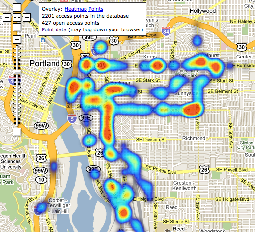
So far I've only made about a dozen trips with the wifi antenna on, but I've already logged 2200 unique mac addresses, and 427 open access points. And this is only on my normal route to and from work, I haven't made any special wardriving trips yet. Here is a heatmap visualization of the access points I've logged so far.

This uses a custom tileserver I wrote to provide an additional data layer to the map. Hotter spots on the map correspond to more open access points in that area.
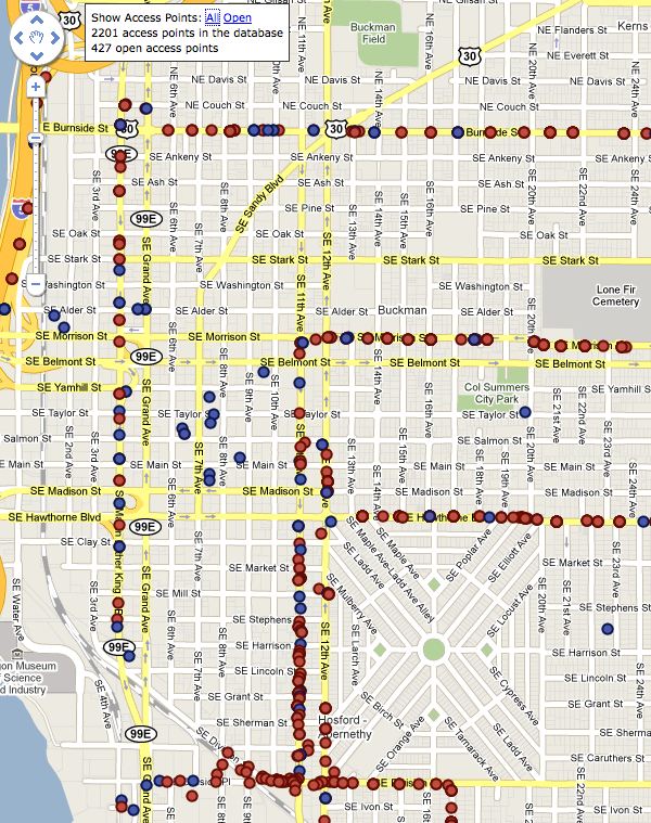
This is a version which shows each access point as a marker on the map so you can click on them.

Most of the access points appear to be in the middle of the street, because most have been seen only one time by my logger, which was in the middle of the street. As the access points are seen repeatedly from other positions, the points will adjust to a more accurate position. You can already see this happening for a few points which appear in the middle of blocks or on streets through which I did not drive.
Again, these maps are still in their infancy, since I've only logged a few days worth of points on very narrow routes. But it's amazing that I've already driven by 2200 access points just in the normal course of the day. I'm looking forward to continuing logging data and eventually importing it into the geomena database. It's easy to see how quickly we could map out the entire city with just a couple people running loggers!
