Since I've already been logging GPS data for quite some time, I thought it'd be interesting to log as much data during flights as possible. Of the three flights so far, I've been able to log data on two of them. I think it has to do with the fact I had a window seat on both flights. I'm pretty sure the plane is shielded in a way that blocks the satellite signals. I'd be interested if anybody can fill me in on why this might be.
I put my phone into "airplane mode" so that it doesn't broadcast anything, but turn on the GPS logger. I was able to keep a lock for the entire flight!

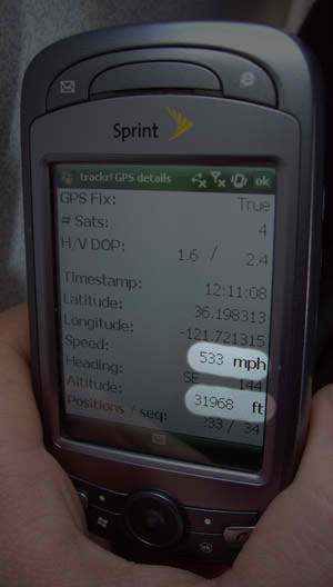
GPS at 30000 feet!

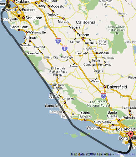
San Francisco to Long Beach

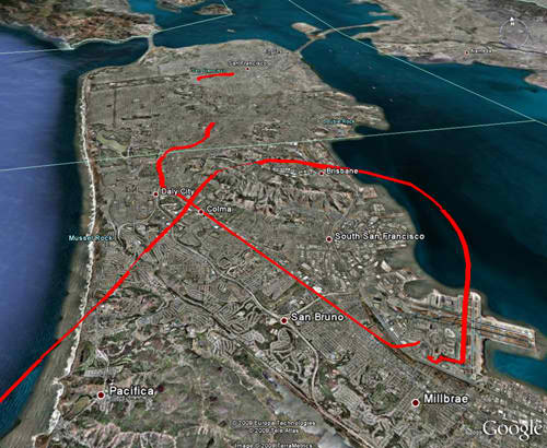
Takeoff from San Francisco
This is the beginning of the flight from San Francisco, loaded into Google Earth. It also includes taking the BART to the airport. The actual flight starts at the gap at the bottom.
I also have altitude data at every point, but I can't seem to get Google Earth to display it. If you have any ideas please let me know!
