About the These Maps
These are images of map generated entirely from GPS logs gathered by various versions of the Geoloqi sample application for iPhone and Android for the past 3.5 years. Once gathered, the data was run through a custom script that projects the GPS logs onto a 2D image plane. There is a little bit of logic to smooth out the lines and remove some (but not all) GPS noise.
How Many Data Points?
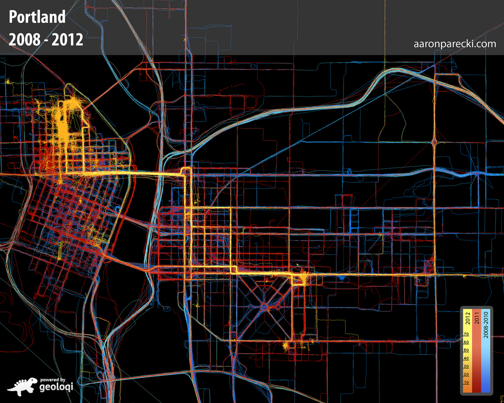
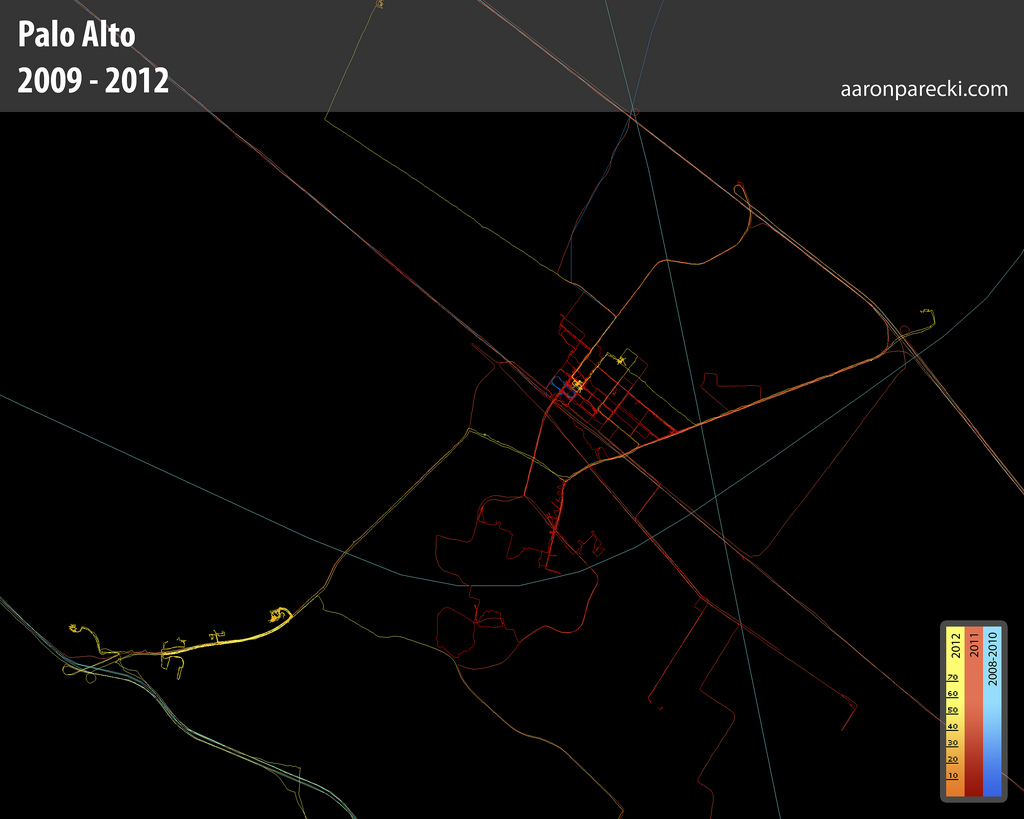
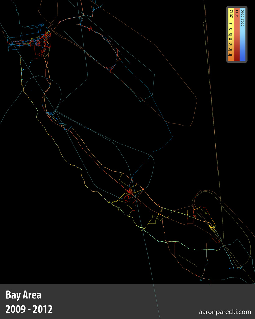
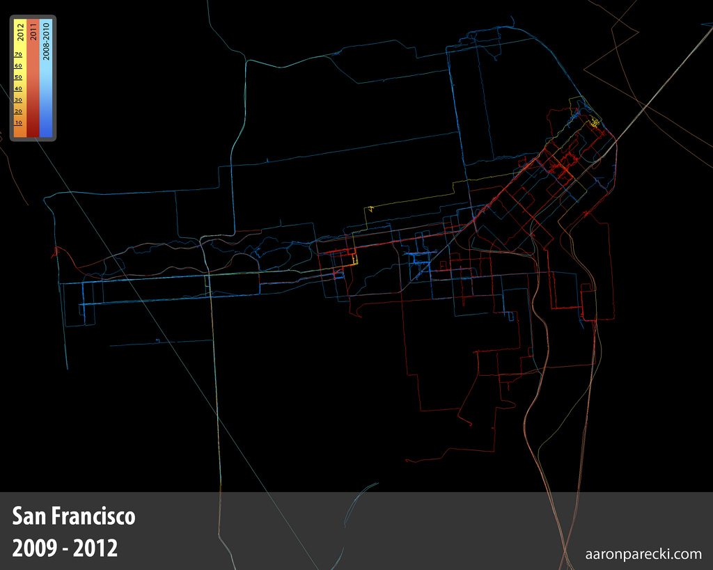
Approximately one GPS point was recorded every 2-6 seconds when I was moving, and these images represent about 2.5 million total GPS points. Collectively, they represent a data portrait of my life: everywhere I’ve been and the places I’ve been most frequently. The map is colored by year, so you can see how my footprint changes over the years, depending on where I live.
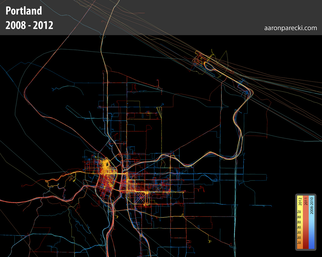
This is a map of everywhere I’ve been in Portland from 2008 to March 2012.
The long diagonal lines are airplane flights in and out of PDX. Some of the flights loop over the city when they take off.
Methods
To get data at this resolution, I had to bring back-up batteries with me and charge my phone whenever I could. I would manually turn the tracker on when I moved, and turn it off when I was at an indoor location for a long period of time. To get this level of accuracy results in a great deal of battery drain.
One of the reasons why I started Geoloqi is to be able to make tracking this kind of data easier for myself, and to improve battery life (along the way we took some of my manual methods for battery management and bundled it up into a set of mobile SDKs for iPhone and Android for adding location to applications without the intensive battery drain).
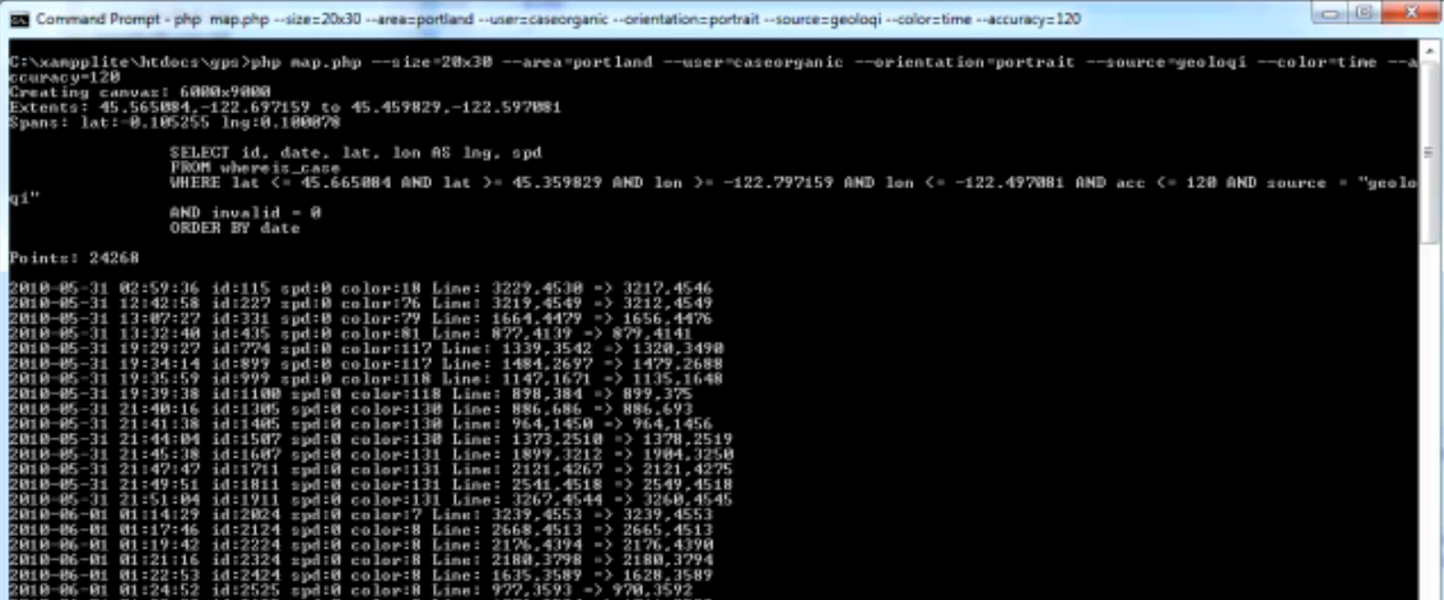
Below is an image of the script while it is running to produce the GPS maps. You can see a video of it processing a couple million GPS points here.
Use in Media
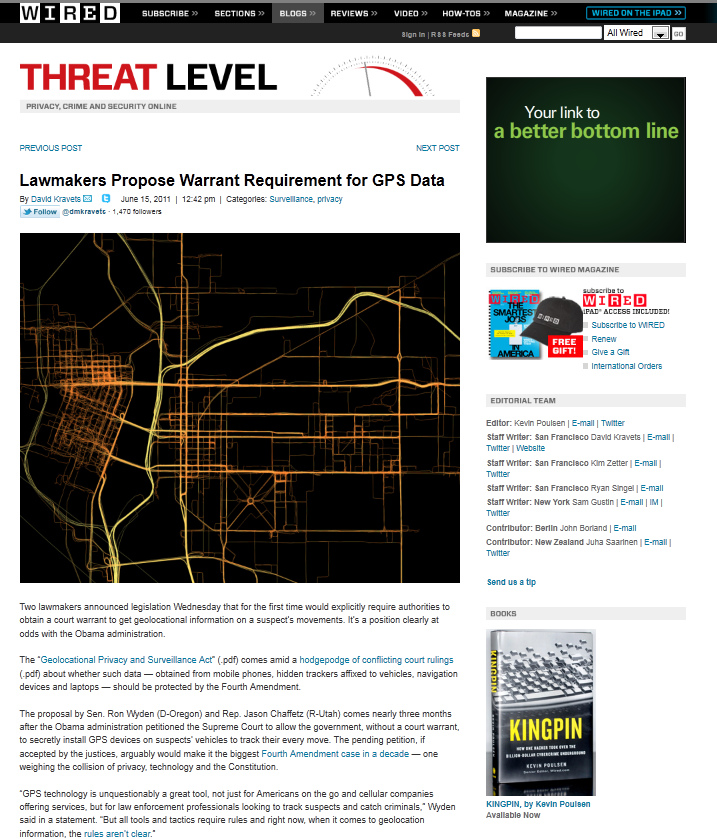
Some of the earlier images of the GPS maps started appearing in Wired online starting last year.
History
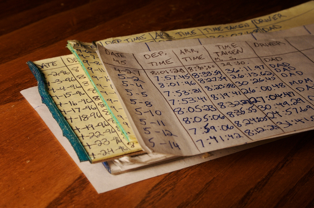
My fascination with GPS and data logging began at a relatively early age (around 10-12 years old, from 4th-6th grade). I recently found my stack of notepads from 3/29/1995 through 6/9/1997 where I logged my commute to school. I have mostly complete logs for the entire date range, including start time, end time, time traveled, who drove, and in what car. On road trips, I used to highlight our path on a giant fold-out map in real time.
Why do This?
I’ve always found it interesting to take raw data and make it visible. Before GPS chips were available in smartphones, it was very difficult to get high resolution data like this. Ubiquitous provides a way to see over time what was formerly invisible data. It allows one to see over time. In each of these cases, I’ve been able to process the raw data to answer personal questions like “what time is best to leave the house in the morning for work?”. Best of all, it is private data that I own and can do with what I like.
More Images
If you’d like to see all of the images I’ve recorded over the past 3.5 years, check out my GPS Logs set on Flickr.